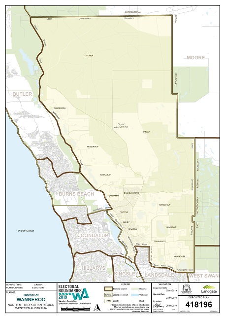
About the Wanneroo Electorate
Number of Electors: 31,301 (13 March 2021)
Source: Western Australian Electoral Commission. State Electorate Information.
History
In the early days of the Swan River Colony, the district of Wanneroo represented an "outer" region and it is not until 1834, that an excursion into the area by any explorers or settlers is recorded. In that year, a party of four led by John Butler, travelled about 35 miles north from Perth to search for lost cattle and passed through the area just to the east of Lake Joondalup. Butler stated that the aborigines of the area were "those Wanneroo men who frequent Perth in company with the Yellowgonga tribe." It is not known when early settlers started using the name "Wanneroo", but, as early as 1842, a Surveyor recorded "road to Wanneroo" and in 1844, James Dobbins gave his address as Wanneroo. A government townsite was gazetted as "Wanneru" in August 1907 and it was not until May 1953 that the spelling was amended to "Wanneroo".
Source: Western Australia. Department of Land Administration. Names and Places.
Suburbs/Towns
Ashby; Banksia Grove; Carabooda *; Carramar; Gnangara; Jandabup; Mariginiup; Neerabup *; Nowergup; Pinjar; Sinagra; Tapping; Wanneroo
* = Suburb/Town split between more than one Electorate.
Source: Western Australian Electoral Commission.
Schools
Government: Banksia Grove Primary School; Carramar Primary School; East Wanneroo Primary School; Grandis Primary School; Joseph Banks Secondary College; Spring Hill Primary School; Tapping Primary School; Wanneroo Primary School; Wanneroo Secondary College.
Other: St Anthony's School; St John Paul II Catholic Primary School.
Local Governments within District
City of Wanneroo (part) ; Statistical Profile of City of Wanneroo